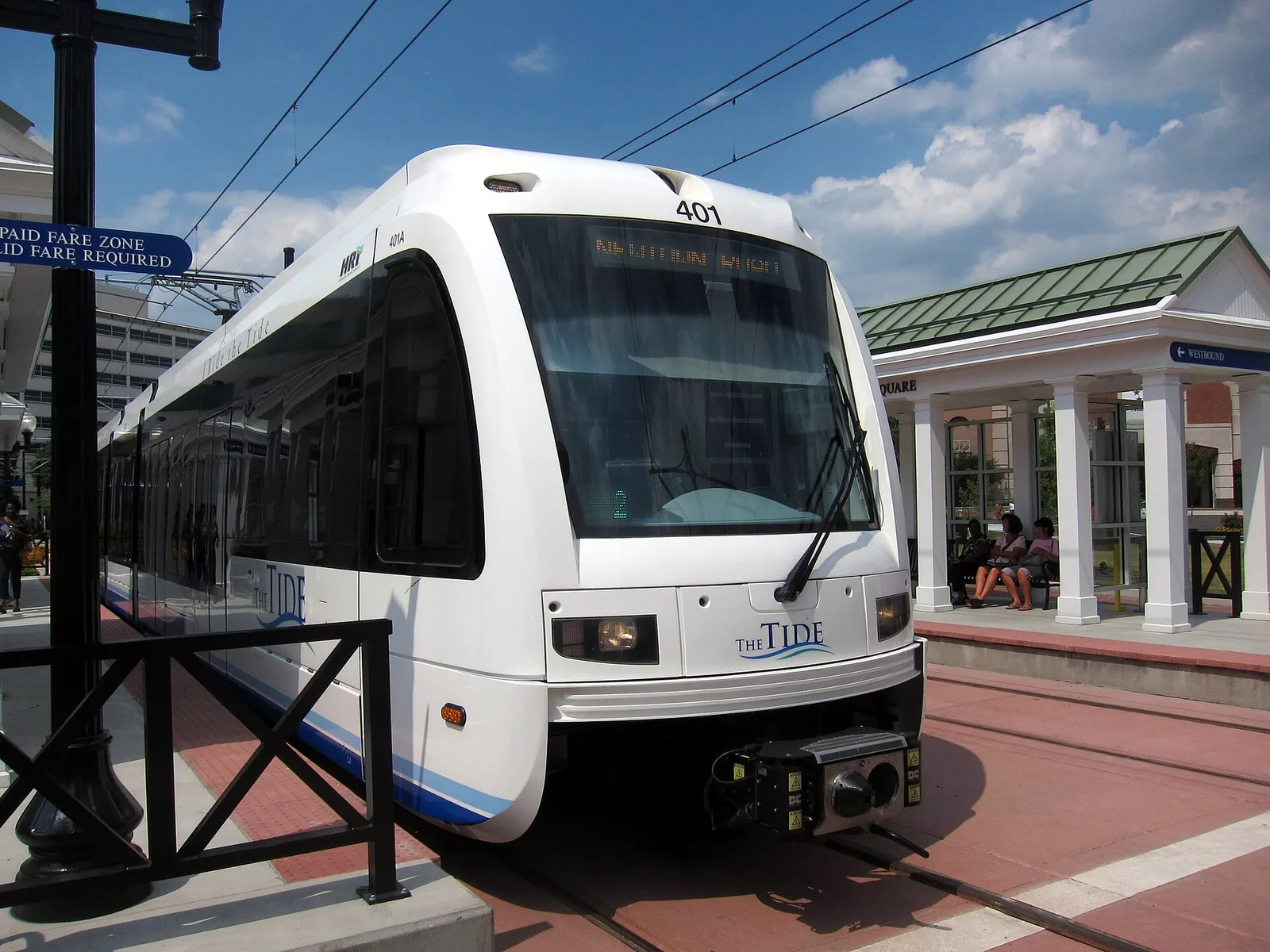
Norfolk by car, bus, light rail, ferry and bike: The Tide's 11 stations, HRT bus routes, Norfolk International Airport and downtown meters, free after 6 p.m.
Last checked Oct. 19, 2026. Facts come from Hampton Roads Transit, the City of Norfolk’s Parking Division and biking page, and Norfolk International Airport.
Norfolk is surrounded by water, so the way in and out is usually a bridge or a tunnel. For live traffic, crashes and lane closures, use 511 Virginia or dial 511. For this fall’s closures, including the Hampton Roads Bridge-Tunnel, see our road construction guide.
Who to call
- Buses, light rail and ferry: Hampton Roads Transit, 757-222-6100 (24-hour schedules and arrivals; press 2 for Spanish)
- Parking, permits and broken meters: Parking Division, 757-664-6222; Customer Service Center, 222 E. Main St., 8:30 a.m. to 4:30 p.m. weekdays
- Potholes and signals: Norfolk Cares, 757-664-6510
- Interstates and tunnels: VDOT, 800-FOR-ROAD (800-367-7623)
Main roads
Three interstates serve the city: I-64, which crosses the harbor to Hampton on the Hampton Roads Bridge-Tunnel, now being widened in VDOT’s $3.9 billion HRBT Expansion; I-264, which meets Ballentine Boulevard, where the city is designing lane improvements; and I-564, which crosses East Little Creek Road beside I-64. Express Lanes are being added on I-64 between Patrol Road and Tidewater Drive. Details and current closures are in our road construction guide.
The Tide light rail
Hampton Roads Transit’s The Tide runs across Norfolk with 11 stations, west to east, on HRT’s light rail page:
- EVMC/Fort Norfolk
- York Street/Freemason
- Monticello
- MacArthur Square
- Civic Plaza
- Harbor Park
- NSU (Norfolk State University)
- Ballentine/Broad Creek
- Ingleside Road
- Military Highway
- Newtown Road
Newtown Road Station has free parking. Pay with HRT’s GoMobile app or at a station ticket machine, and scan your ticket at the platform validator before you board, HRT says. Rides on buses, light rail and the ferry are free on Election Day, Tuesday, Nov. 3.
Buses
HRT runs more than 25 routes in Norfolk, most from the Downtown Norfolk Transit Center, on its Norfolk routes page. Some you may use:
- Route 1: Downtown to Joint Expeditionary Base Little Creek
- Route 3: Downtown to Ocean View Avenue
- Route 4: Downtown to Old Dominion University
- Route 20 (express): Downtown to the Virginia Beach Oceanfront
- Route 23: Sentara Norfolk General, IKEA, JANAF and Military Circle
- Route 45: Downtown to Portsmouth and Chesapeake
- Route 961 (express): Norfolk to Hampton and Newport News
HRT also runs a Naval Station Norfolk base circulator. Plan a trip at gohrt.com.
Ferry
The Elizabeth River Ferry crosses between downtown Norfolk and Portsmouth. On Norfolk Tides home game days it also runs every 30 minutes between North Landing in Portsmouth and Harbor Park, starting an hour before the game, HRT’s ferry page says.
Norfolk International Airport
Norfolk International Airport (ORF) is at 2200 Norview Ave., in the city. It is in the middle of what it calls its largest modernization since its departures terminal opened in 1974, nearly $1 billion in improvements, its website says. Taxis, ride share and rental cars are on its ground transportation page, and parking on its parking page.
Biking and walking
Norfolk has nearly 60 miles of bike lanes and shared lane markings and a dockless bike-share program, the city’s biking page says. The Elizabeth River Trail runs 10.5 miles from the Naval Station area through downtown to Norfolk State University, and Northside Park has a 3-mile mountain bike trail. See our parks and trails guide.
Parking downtown
From the city’s meter tips and metered parking pages:
- Time limit: two hours at meters, except 15 minutes at the meters in front of Waterside.
- Enforcement: downtown and ODU Village meters, 9 a.m. to 6 p.m. Monday through Friday; Spotswood meters in Ghent, 8 a.m. to 8 p.m. Monday through Saturday.
- Free: metered parking is free after 6 p.m. Monday through Saturday and all day Sunday.
- Pay: cards or coins at the meter, or ParkMobile by app, text, phone or online.
- Bagged meters: do not park; you can be towed.
- Longer stays: use a city garage. The city’s garages and lots page and map list them; Bank Street, Fountain Park, Freemason Street, MacArthur, Town Point, Waterside and York Street garages have electric car chargers.
- Neighborhood permit zones: residents apply through the city’s residential parking portal; each household gets one free yearly visitor pass.
Parking tickets can be paid online.
What this means for you
- Downtown after 6 p.m. or on Sunday, street meters are free.
- The Tide is the easy way to downtown events; park free at Newtown Road.
- Check 511 before any trip through a tunnel.
Related: road construction and closures, moving to Norfolk and parks and trails.
Frequently asked questions
Where does The Tide light rail go in Norfolk?
The Tide runs through Norfolk from EVMC/Fort Norfolk Station through downtown, past Norfolk State University and out to Newtown Road Station, with 11 stations in all.
Is parking free in downtown Norfolk?
Downtown meters are free after 6 p.m. Monday through Saturday and all day Sunday. They are enforced 9 a.m. to 6 p.m. weekdays, with a two-hour limit.
How do I pay for parking in Norfolk?
At the meter with cards or coins, or with the ParkMobile app, by text, by phone or online. City garages and lots are listed on the city’s parking map.
What is the Hampton Roads Transit phone number?
757-222-6100, for schedules and real-time bus arrival times, 24 hours a day. Press 2 for Spanish.
Where is Norfolk International Airport?
At 2200 Norview Ave. in Norfolk. The airport lists taxis, ride share and rental cars on its ground transportation page.
Have your say