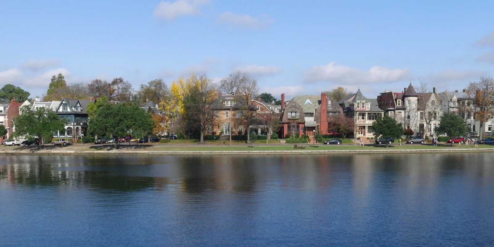
Ghent covers about 612 acres, mostly ZIP 23507, where Zillow's typical home value was $478,728 in September 2026, the highest in Norfolk.
Last checked Oct. 20, 2026. Sources: the City of Norfolk’s civic league map, zoning overlays, parks layer and NFK2050 existing conditions report (PDF), Norfolk Public Schools’ 2026-27 attendance boundaries, the state’s School Quality Profiles, Zillow Research, Hampton Roads Transit’s schedule data and OpenStreetMap.
Ghent is the neighborhood of turn-of-the-century houses and apartment buildings northwest of Downtown, around the Hague, an inlet of the Elizabeth River. The city’s NFK2050 report says Ghent and West Ghent were laid out in the 1890s and 1900s, and that the Pelham Place and Holland apartments went up in Ghent around the time of the 1907 Jamestown Exposition.
What this means for you
- Zoned high school: Maury High for all of Ghent in 2026-27. Check an address with Find My School.
- Home value: $478,728 in ZIP 23507 in September 2026, according to the Zillow Home Value Index.
- Nearest interstate exit: I-264 exit 9 (Waterside Drive) or exit 10 (City Hall Avenue), about 1.7 miles from the middle of Ghent in a straight line.
Part of our Norfolk neighborhoods guide.
Where it is
On this page Ghent is three civic league areas on the city’s map: the Ghent Neighborhood League, West Ghent and the Ghent Square Community Association, about 612 acres together. Colley Avenue, Olney Road, Brambleton Avenue and Princess Anne Road are the main streets.
About 73% of the area is in ZIP code 23507, 21% in 23517 to the north and 6% in 23510. Almost all of it, 98%, is in the city’s Traditional character district.
Historic district. Ghent is one of the city’s four locally designated historic districts, the NFK2050 report says, along with East Freemason, West Freemason and the Downtown overlay. “All major architectural changes must be approved through the design review process” there. On the zoning map, about 15% of the area carries the Ghent historic zoning (HC-G1 and HC-G2).
Shops and the medical center. The Colley Avenue Pedestrian Commercial Overlay covers the Colley Avenue shops, and a Medical Center overlay district covers part of the south side, toward the EVMC/Fort Norfolk light rail station.
Flood risk. About 70% of the area is in the city’s Coastal Resilience Overlay, which the Zoning Ordinance applies to “areas of the city subject to higher flood risk.” See our hurricane prep guide.
Schools
These are the approved 2026-27 zones, from Norfolk Public Schools’ boundary locator. All of Ghent falls in one zone at each level. Ratings are the state’s 2025-26 School Performance and Support Framework level and score; all three schools were fully accredited.
| Level | School | Address | State rating |
|---|---|---|---|
| Elementary | Walter Herron Taylor Elementary | 1122 W. Princess Anne Road | Meets Expectations, 93.41 |
| Middle | Blair Middle | 730 Spotswood Ave. | Needs Intensive Support, 78.77 |
| High | Maury High | 322 Shirley Ave. | Meets Expectations, 86.93 |
Ghent K-8, rated Distinguished (94.19), has no zone of its own on the 2026-27 map. The division’s consolidation timeline had listed it for closure and a move to Rosemont in 2027-28, but on Thursday, Oct. 15, the division said Ghent School would not be included in that phase, and it held a community meeting at the school Monday, Oct. 19. More in our schools guide.
Home values
The typical home value in ZIP 23507 was $478,728 in September 2026, up 0.9% from $474,661 a year earlier, according to the Zillow Home Value Index. That is the highest of any Norfolk ZIP code in Zillow’s file. In 23517, which covers north Ghent and Park Place, it was $321,257, down 0.8% from $323,919. The index is a modeled typical value for the middle third of homes, not a sale price. The citywide figure was $310,673. More in our home prices guide.
Parks and trails
From the city’s parks records, all inside the area:
- Hague Dog Park, 700 W. Brambleton Ave., 5.2 acres
- Stockley Gardens, the landscaped median of Stockley Gardens, 600 to 800 and 1200 to 1400 blocks, with the Stockley Garden Dog Park at 1300 Stockley Gardens
- Botetourt Gardens, 600 to 800 and 1100 to 1200 blocks, and the Fred Huette Center, 1000 Botetourt Gardens
- Jeff Robertson Park, 1220 Azalea Court, 9.7 acres
- Fergus Reid Tennis Courts, 915 Orapax Ave.
- Raleigh Avenue Playground, 635 Raleigh Ave., and Redgate Playground, 935 Redgate Ave.
- Stone Park, 601 W. Olney Road, and Yellow Fever Park, 900 W. Princess Anne Road
The city’s mapped route of the Elizabeth River Trail runs through the area. The Van Wyck Branch Library is at 1368 DeBree Ave., just north. More in our parks guide and walking and biking trails guide.
Getting around
- Interstate 264: exit 9 (Waterside Drive) and exit 10 (City Hall Avenue and Tidewater Drive), by the signs mapped in OpenStreetMap, about 1.7 miles from the middle of Ghent in a straight line.
- City Hall: about 2 miles by road.
- Norfolk International Airport: about 6.9 miles. Both are distances measured on the OpenStreetMap road network with the OSRM routing engine, not drive times.
- The Tide: EVMC/Fort Norfolk Station is about 0.4 mile from the middle of Ghent, and York Street/Freemason Station is about 0.7 mile.
- Hampton Roads Transit buses with stops here: routes 2 (Hampton Boulevard), 11 (Colonial Avenue), 23 (Princess Anne Road) and 44 (Midtown).
More in our getting around guide.
Groceries and everyday stores
From OpenStreetMap:
- Harris Teeter, 1320 Colonial Ave., inside the area
- Along West 21st Street, just north: The Fresh Market, 855 W. 21st St.; Aldi, 730 W. 21st St.; and Walgreens, 810 W. 21st St.
- Food Lion, 2401 Colley Ave.
How we drew this area
Ghent here is the Ghent Neighborhood League, West Ghent and Ghent Square civic league areas on the city’s civic league map. School and ZIP code shares were measured on a grid of points across them. Store locations and exit numbers are © OpenStreetMap contributors.
Frequently asked questions
What ZIP code is Ghent in Norfolk?
Most of Ghent is in ZIP 23507, and the northern part is in 23517. Zillow put the typical home value at $478,728 in 23507 and $321,257 in 23517 in September 2026.
What schools serve Ghent in Norfolk?
All of Ghent is zoned for Taylor Elementary, Blair Middle and Maury High for 2026-27. Taylor and Maury were rated Meets Expectations for 2025-26 on the state’s School Quality Profiles.
Is Ghent a good place to live?
Ghent is in Norfolk’s Traditional character district, with more than 15 city parks and playgrounds, the Elizabeth River Trail and The Tide’s EVMC/Fort Norfolk station nearby. It is zoned for Maury High, rated Meets Expectations for 2025-26, and the typical home value in 23507 was $478,728 in September 2026, according to Zillow.
Is Ghent a historic district?
Yes. Ghent is one of Norfolk’s four locally designated historic districts, the city’s NFK2050 report says, so major exterior changes in the district need design review.
Have your say