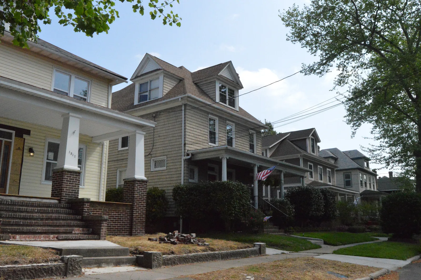
Eleven Norfolk neighborhoods compared: ZIP codes, 2026-27 zoned high schools and Zillow home values from $259,921 in 23523 to $478,728 in 23507.
Last checked Oct. 20, 2026. Sources: the City of Norfolk’s civic league map layer, planning districts, parks layer and NFK2050 existing conditions report (PDF), Norfolk Public Schools’ approved 2026-27 attendance boundaries, the state’s School Quality Profiles, the Census Bureau, Zillow Research and OpenStreetMap.
About 235,000 people live in Norfolk, the Census Bureau’s 2019-2023 American Community Survey says. This guide splits the city into 11 neighborhoods you can find on the city’s own map, each with its own page: where it is, zoned schools, home values, parks, commute and stores.
What this means for you
- School zones do not follow neighborhood lines. Park Place and Downtown are each split between two high school zones. Check one address with the division’s Find My School tool.
- Several elementary schools close next year. Granby, Lindenwood, P.B. Young and Tarrallton are planned to close for 2027-28, the division’s consolidation timeline says, and their zones will be redrawn. Ghent School was taken out of that phase on Thursday, Oct. 15.
- There is no county. Norfolk is an independent city: one real estate rate, $1.23 per $100 for fiscal 2027, and one school division. See property taxes.
How the city is laid out
Water on three sides. The Chesapeake Bay forms the north shore, from Willoughby Spit to East Ocean View. The Elizabeth River runs along the west and south, past Downtown and Berkley, and the Lafayette River cuts into the middle of the city past Larchmont and Colonial Place. Naval Station Norfolk fills the northwest corner. The city’s NFK2050 report calls it “the largest Navy installation in the world.”
Civic leagues are the neighborhoods. Norfolk “has more than 80 active Civic Leagues,” the NFK2050 existing conditions report says, and they “represent more than a name or a boundary”: under the Zoning Ordinance they get a voice whenever nearby property is rezoned. The city maps 119 of them, and this guide uses their boundaries. The city also splits Norfolk into 44 numbered planning districts.
Four character districts. Since plaNorfolk2030, the zoning code sorts the city into Downtown, Traditional (the older grid of small lots, such as Ghent, Park Place and Berkley), Suburban (later neighborhoods such as Larchmont, Wards Corner and Norview) and Coastal (the bay shore). The report says the Traditional areas have “smaller parcels with varied land uses and dense street networks.” NFK2050, the new comprehensive plan, took effect Jan. 1, 2026.
Three interstates. Interstate 264 runs from the Downtown Tunnel past Downtown and east to Virginia Beach. Interstate 64 crosses the north of the city from the Hampton Roads Bridge-Tunnel at Willoughby Spit to the airport, and Interstate 564 links I-64 to the naval station.
Fourteen ZIP codes. By the Census Bureau’s 2020 relationship file, 14 ZIP code areas have at least 10% of their land in the city. Zillow publishes home values for 12 of them.
The neighborhoods at a glance
Zoned high school is the 2026-27 zone covering most of each area. Home values are the Zillow Home Value Index for September 2026, a modeled typical value for the middle third of homes, not a sale price. The citywide figure was $310,673.
| Neighborhood | Main ZIP | Zoned high school | Typical home value in that ZIP | Page |
|---|---|---|---|---|
| Downtown | 23510 | Maury (part Booker T. Washington) | $327,623 | Downtown |
| Ghent | 23507 | Maury | $478,728 | Ghent |
| Larchmont and Edgewater | 23508 | Maury | $379,098 | Larchmont |
| Colonial Place and Riverview | 23508 | Maury | $379,098 | Colonial Place |
| Park Place | 23508 | Maury and Granby (split) | $379,098 | Park Place |
| Wards Corner | 23505 | Granby | $327,470 | Wards Corner |
| Norview | 23513 | Norview | $271,833 | Norview |
| Ocean View | 23503 | Granby | $315,126 | Ocean View |
| Willoughby | 23503 | Granby | $315,126 | Willoughby |
| East Ocean View | 23518 | Lake Taylor | $342,482 | East Ocean View |
| Berkley | 23523 | Maury | $259,921 | Berkley |
On the state’s 2025-26 School Quality Profiles, Maury and Lake Taylor high schools were rated Meets Expectations, Granby and Norview Approaching Expectations and Booker T. Washington Needs Intensive Support; all five were fully accredited. More in our schools guide and home prices guide.
Downtown
The 308-acre Downtown Norfolk Civic League area on the Elizabeth River, with the Downtown Historic Overlay, The Tide light rail and I-264 exits 9 and 10. ZIP 23510. Read the Downtown page.
Ghent
The Ghent Neighborhood League, West Ghent and Ghent Square areas northwest of Downtown, about 612 acres around the Hague and Colley Avenue, with locally designated historic zoning. Mostly ZIP 23507. Read the Ghent page.
Larchmont and Edgewater
About 946 acres on Hampton Boulevard between the Lafayette and Elizabeth rivers, beside Old Dominion University. ZIP 23508; Larchmont Elementary is in the middle of it. Read the Larchmont and Edgewater page.
Colonial Place and Riverview
Two older neighborhoods on the Lafayette River around the Granby Street bridge, covered by their own zoning overlay to keep porches and front yards. ZIP codes 23508 and 23504. Read the Colonial Place and Riverview page.
Park Place
A 306-acre neighborhood of small lots around Colonial Avenue and West 29th Street, with its own zoning overlay and the Park Place Branch Library. Split among 23508, 23517 and 23504. Read the Park Place page.
Wards Corner
The residential area west of the Granby Street and Little Creek Road crossroads, next to I-64 exit 276 and I-564. ZIP 23505. Read the Wards Corner page.
Norview
The neighborhood around Five Points, where Chesapeake Boulevard, Sewells Point Road and Norview Avenue meet, under a mile from I-64 exit 279. ZIP 23513. Read the Norview page.
Ocean View
The bay-front civic league area around Ocean View Beach Park and Sarah Constant Beach Park, next to I-64 exit 273. ZIP 23503. Read the Ocean View page.
Willoughby
The spit at the mouth of Hampton Roads, between the Chesapeake Bay and Willoughby Bay, at I-64 exit 272. ZIP 23503. Read the Willoughby page.
East Ocean View
About 888 acres of bay front along Shore Drive, including the East Beach area, with 18 public beach access points. ZIP 23518. Read the East Ocean View page.
Berkley
The Southside neighborhood across the Elizabeth River from Downtown, reached by the Berkley Bridge and I-464. ZIP 23523. Read the Berkley page.
Comparing Norfolk with its neighbors
Taxes, schools, home values and commutes in Norfolk, Portsmouth, Hampton and Poquoson, side by side: Norfolk vs Portsmouth vs Hampton vs Poquoson. Also see moving to Norfolk, getting around and parks and trails.
How we built this
- Which areas: each neighborhood is one or more civic league areas on the city’s civic league map, using the city’s boundary. Ghent combines the Ghent Neighborhood League, West Ghent and Ghent Square areas. We picked 11 areas that cover each part of the city, the older Traditional neighborhoods, the bay shore and the Suburban middle, and that also appear as place names in OpenStreetMap or the city’s planning districts.
- Left out: many smaller civic leagues, the naval station, Old Dominion University’s campus as a separate area, and individual subdivisions.
- Schools: the division’s approved 2026-27 attendance boundaries, checked Oct. 20, 2026. Shares of each area in each zone were measured on a grid of points.
- Home values: Zillow’s ZIP code file for September 2026.
- Distances: measured on the OpenStreetMap road network with the OSRM routing engine.
- Map data: stores, exit numbers and place names are © OpenStreetMap contributors.
Frequently asked questions
What are the neighborhoods in Norfolk, Virginia?
Norfolk is divided into more than 100 civic league areas on the city’s map, from Downtown and Ghent to Ocean View, Willoughby, Wards Corner, Norview and Berkley. This guide covers 11 of them, each drawn with the city’s own civic league boundary.
How many ZIP codes does Norfolk have?
Fourteen ZIP code areas have at least 10% of their land in the city, by the Census Bureau’s 2020 relationship file. Zillow publishes home values for 12 of them; 23511 (Naval Station Norfolk) and 23551 are not in its file.
Which Norfolk ZIP code has the highest home values?
23507, which covers most of Ghent. Zillow’s typical home value there was $478,728 in September 2026. The lowest was 23523, which covers Berkley, at $259,921. The citywide figure was $310,673.
Do Norfolk school zones follow neighborhood lines?
No. Park Place is split between the Maury and Granby high school zones, and Downtown between Maury and Booker T. Washington. Check one address with Norfolk Public Schools’ Find My School tool.
Are Norfolk school zones changing?
Yes. The division closed Norview and Oceanair elementary schools in summer 2026 and plans to close Granby, Lindenwood, P.B. Young and Tarrallton elementary schools for 2027-28, with new boundaries for those areas. On Thursday, Oct. 15, it said Ghent School would not be part of that phase.
Have your say