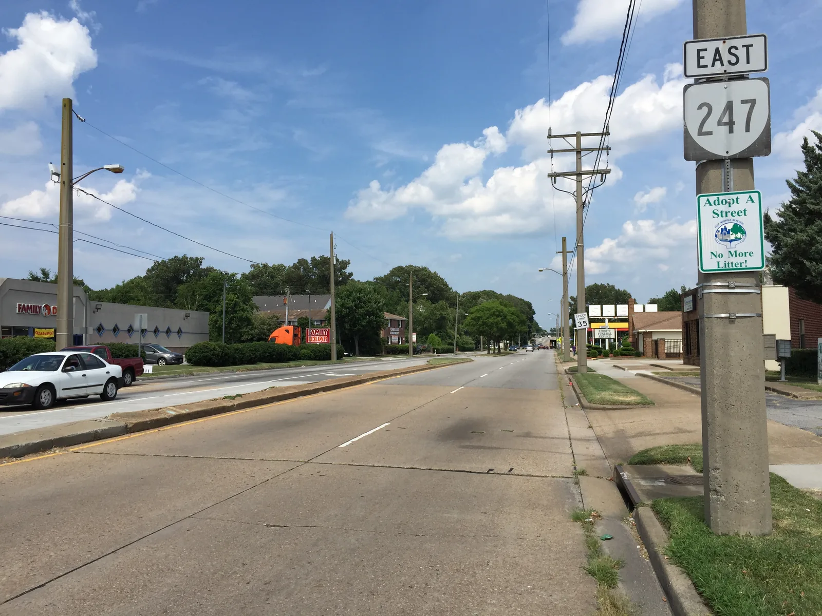
Norview covers 227 acres around Five Points in ZIP 23513, where Zillow's typical home value was $271,833 in September 2026. Zoned for Norview High.
Last checked Oct. 20, 2026. Sources: the City of Norfolk’s civic league map, zoning overlays, parks layer and NFK2050 existing conditions report (PDF), Norfolk Public Schools’ 2026-27 attendance boundaries and consolidation timeline, the state’s School Quality Profiles, Zillow Research, Hampton Roads Transit’s schedule data and OpenStreetMap.
Norview is the neighborhood around Five Points, where Chesapeake Boulevard, Sewells Point Road and Norview Avenue meet, between the middle of the city and Norfolk International Airport. The city’s NFK2050 report pictures the street art at Five Points and the Norview Community Center as examples of the city’s gathering places. This page uses the Norview civic league area on the city’s map, about 227 acres.
What this means for you
- Zoned high school: Norview High for almost all of the area in 2026-27. Check an address with Find My School.
- Home value: $271,833 in ZIP 23513 in September 2026, according to the Zillow Home Value Index.
- Nearest interstate exit: I-64 exit 279 (Norview Avenue), about 0.8 mile from the middle of the area.
Part of our Norfolk neighborhoods guide.
Where it is
All of the area is in ZIP code 23513 and in the city’s Suburban character district. Single-family zoning covers most of the land: SF-10 about 52% and SF-6 about 12%. Chesapeake Boulevard and Sewells Point Road are the main north-south roads, and Norview Avenue runs east to the airport.
Flood risk. About 36% of the area is in the city’s Coastal Resilience Overlay, which the Zoning Ordinance applies to “areas of the city subject to higher flood risk.” See our hurricane prep guide.
Schools
These are the approved 2026-27 zones, from Norfolk Public Schools’ boundary locator. Ratings are the state’s 2025-26 School Performance and Support Framework level and score; all were fully accredited.
| Level | School | Address | State rating |
|---|---|---|---|
| Elementary | Sherwood Forest Elementary | 3035 Sherwood Forest Lane | Approaching Expectations, 80.35 |
| Middle | Norview Middle | 6325 Sewells Point Road | Needs Intensive Support, 67.19 |
| High | Norview High | 1070 Middleton Place | Approaching Expectations, 78.6 |
Norview Elementary closed in summer 2026. Its students were redistricted to Sherwood Forest and Tanners Creek elementary schools for 2026-27, the division’s consolidation timeline says. About 4% of the civic league area, at its edge, is zoned for Willard Elementary.
Norview High is home to the division’s Leadership Center for the Sciences and Engineering, our schools guide notes.
Home values
The typical home value in ZIP 23513 was $271,833 in September 2026, up 2.2% from $265,944 a year earlier, according to the Zillow Home Value Index. The index is a modeled typical value for the middle third of homes, not a sale price, and it covers the whole ZIP code, not Norview alone. The citywide figure was $310,673, up 1.5%. More in our home prices guide.
Parks and recreation
From the city’s parks records:
- Five Points Park and Civic Plaza, 6107 Sewells Point Road, inside the area
- Norview Middle School grounds, 6325 Sewells Point Road, a 17.2-acre school and park site on the city’s list, at the edge of the area
More in our parks guide.
Getting around
- Interstate 64: exit 279 (Norview Avenue, signed for Norfolk International Airport) and exit 278 (Chesapeake Boulevard), by the signs mapped in OpenStreetMap, both about a mile away.
- Norfolk International Airport: about 2.8 miles by road from the middle of the area.
- City Hall: about 5 miles. Both are distances measured on the OpenStreetMap road network with the OSRM routing engine, not drive times.
- Hampton Roads Transit: routes 3 (Chesapeake Boulevard) and 9 (Sewells Point Road) stop in the area.
More in our getting around guide.
Groceries and everyday stores
From OpenStreetMap:
- Family Dollar, 6130 Chesapeake Blvd., about half a mile from the middle of the area
- Food Lion, 3530 Tidewater Drive, about 0.8 mile
- Lidl, 6440 N. Military Highway, about 1.4 miles
How we drew this area
Norview here is the civic league area of that name on the city’s civic league map. Several neighboring civic leagues, such as Greenwood, Elmhurst and Norview Heights, are separate on the city’s map and are not included. School and ZIP code shares were measured on a grid of points. Store locations and exit numbers are © OpenStreetMap contributors.
Frequently asked questions
What ZIP code is Norview in Norfolk?
The Norview civic league area is entirely in ZIP 23513. Zillow put the typical home value there at $271,833 in September 2026, up 2.2% from a year earlier.
What schools serve Norview?
For 2026-27, Norview is zoned for Sherwood Forest Elementary, Norview Middle and Norview High. Norview Elementary closed in summer 2026, and its students were reassigned to Sherwood Forest and Tanners Creek elementary schools.
Is Norview a good place to live?
Norview is a Suburban district neighborhood around Five Points, under a mile from I-64 exit 279 and about 2.8 miles by road from Norfolk International Airport. It is zoned for Norview High, rated Approaching Expectations for 2025-26, and the typical home value in 23513 was $271,833 in September 2026, according to Zillow.
Did Norview Elementary close?
Yes. Norfolk Public Schools closed Norview Elementary at the end of the 2025-26 school year. Its students start 2026-27 at Sherwood Forest or Tanners Creek Elementary, under the division’s consolidation plan.
Have your say